
Geography of Türkiye and Antalya
Türkiye sits where Europe and Asia meet, and its landscape is just as varied as its history. Snow-capped volcanoes rise in the east, long rivers cut deep canyons through the Taurus Mountains, and more than 8,000 kilometres of coastline wrap around the peninsula. This section explains that geography in clear, practical language.
Why Geography Matters on Holiday
The landscape shapes almost everything a visitor experiences. The Taurus Mountains give Antalya its cool rivers and canyons, the Mediterranean climate brings long summers, and karst springs feed the turquoise water you see on a rafting or boat trip.
What you will find here
Guides to Türkiye's highest mountains, largest lakes, longest rivers, biggest dams and islands, plus articles on Antalya's climate, physical structure, rivers, lakes and water resources.
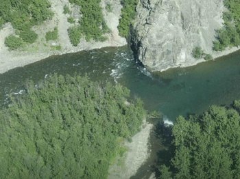
Antalya's rivers are short but full of character. They are born from cold karst springs in the Taurus Mountains and reach the Mediterranean only a few dozen kilometres later, cutting canyons and waterfalls on the way. Did you know that one of them, the Düden, ends by falling straight off a cliff into the sea?

Türkiye is surrounded by water on three sides, and its rivers flow towards four different seas: the Black Sea, the Sea of Marmara, the Aegean and the Mediterranean. A few great rivers, such as the Euphrates and the Tigris, leave the country entirely and reach the Persian Gulf. Did you know that the English word meander comes from a Turkish river, the Büyük Menderes, famous for its winding course?

Few places show such contrasts in such a short distance as Antalya. Within an hour you can drive from sea level to mountain plateaus over 1,000 metres high. Did you know that the city of Antalya itself is built on terraces of travertine, a rock formed from mineral-rich spring water, which is why it ends in cliffs above the sea at Konyaaltı and Lara?

Antalya's steep, water-rich rivers are ideal for hydroelectric power, and several dams have been built across them since the 1980s. Besides producing electricity and irrigating farmland, these dams have created new landscapes. Did you know that the popular Green Canyon boat trip near Manavgat takes place on a reservoir that did not exist before the 1980s?

Antalya is a land of rivers and springs rather than lakes. Because the Taurus Mountains are made of porous limestone, water usually sinks underground instead of collecting in basins. Did you know that most of the large lakes you see around Antalya today are reservoirs created by dams, not natural lakes?
Antalya has a classic Mediterranean climate: hot, dry summers and mild, rainy winters. The city is known for its long sunny season, which is a major reason why it became Türkiye's busiest holiday destination. Did you know that you can find palm trees on the coast and cedar forests with snow in winter less than two hours' drive away?
Antalya is one of the most water-rich parts of Türkiye, even though it has long, dry summers. The secret lies underground. The Taurus Mountains are made largely of limestone that acts like a giant sponge, storing winter rain and snow and releasing it through springs all year round. Did you know that the cliffs at Konyaaltı and Lara were built by this water over thousands of years?
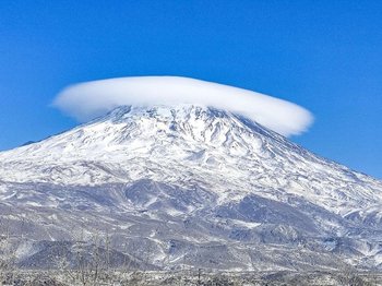
Mount Ağrı, known internationally as Mount Ararat, is the highest mountain in Türkiye at 5,137 metres. It rises almost alone from the surrounding plains near the borders with Iran and Armenia, which makes it look even taller than it is. Did you know that its summit is covered by a permanent ice cap, unusual for a mountain this far south?
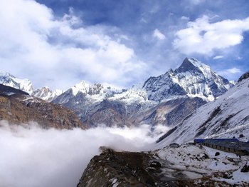
Mount Everest, on the border between Nepal and China, is the highest mountain on Earth above sea level. A joint survey by Nepal and China in 2020 measured its height at 8,848.86 metres. Did you know that, depending on how you measure, two other mountains can also claim the title of highest?
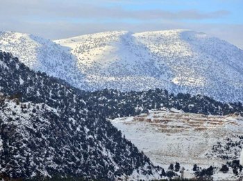
Antalya is famous for its beaches, yet the province is one of the most mountainous in Türkiye. Its highest point is Kızlar Sivrisi in the Bey Mountains, a limestone peak that rises to just over 3,000 metres, usually given as about 3,070 metres. Did you know that from its summit, on a clear day, you can see both the high plateaus inland and the Mediterranean Sea?
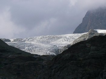
Türkiye is divided into seven geographical regions, and Eastern Anatolia is the highest of them, with the greatest average elevation in the country. Much of the region is a high plateau broken by volcanic mountains and deep river valleys. Did you know that some of its cities lie higher than many ski resorts in Europe?
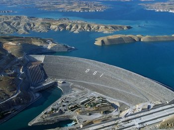
Türkiye has built hundreds of dams to produce electricity, irrigate farmland and control floods. Two of them stand out: the Atatürk Dam, the largest in the country, and the Yusufeli Dam, the highest. Did you know that the reservoir behind the Atatürk Dam is large enough to be counted among Türkiye's biggest lakes?
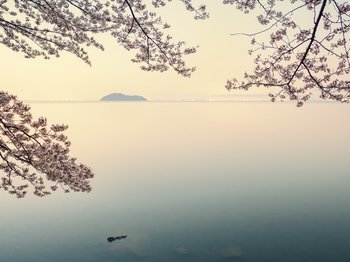
Lake Van in eastern Anatolia is the largest lake in Türkiye, covering an area of roughly 3,700 square kilometres. It sits at an altitude of about 1,640 metres, surrounded by volcanic mountains. Did you know that its water is so alkaline that locals once used it to wash clothes without soap?
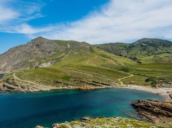
Türkiye's largest island is Gökçeada, in the northern Aegean Sea off the Gallipoli peninsula. It covers about 280 square kilometres, with green hills, quiet villages and long beaches. Did you know that it is also Türkiye's westernmost point, so the country's last sunset each day is seen from its shores?
 Line
 Call